Africa is preparing to launch an unprecedented initiative to generate the first comprehensive, accurate base map of the entire continent—addressing one of its most overlooked but consequential development challenges: the absence of reliable, up-to-date maps that underpin modern governance, infrastructure, and economic activity.
For decades, most African countries have relied on outdated or incomplete maps, hampering everything from land management and national planning to disaster response and investment decisions. While advanced geospatial systems are now standard in much of the world, “maybe 90% of African countries don’t have access to an accurate current base map,” says Sohail Elabd, Global Director of Emerging Markets at Esri and lead architect of the new Map Africa Initiative.
Elabd recounted that at a United Nations conference last year, he met with leaders of national mapping agencies from around 30 African states. Nearly all reported the same problem: their base maps—critical references for roads, land boundaries, infrastructure, agricultural areas, and natural features—were years or decades out of date. Most lacked the funding required for traditional mapping methods, which involve airborne surveys, extensive fieldwork, and months of data collection.
“Everyone was struggling,” Elabd said. “They had no funding, and no way to update their maps using conventional means.”
This data vacuum creates strategic blind spots. Countries struggle to determine optimal locations for renewable-energy installations, manage land registries, direct urban expansion, or even standardize addresses—obstructing the work of delivery companies, emergency services, and local governments.
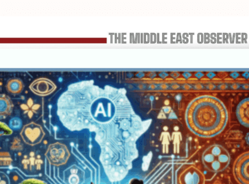
The upcoming Africa-wide mapping project aims to break this cycle by combining high-resolution satellite imagery with artificial intelligence—dramatically cutting the cost and time needed to produce maps at national scale.
AI will be trained to identify features across the continent’s wildly diverse landscapes: homes embedded in rainforest canopies, roads cutting across deserts, shoreline settlements, agricultural fields, and rapidly expanding cities. The system will automatically detect and classify buildings, infrastructure, waterways, and landforms, creating a country-level base map with consistent standards and unprecedented detail.
Beyond physical features, additional layers will map land use, crop types, tree species, urban infrastructure, and vegetation cover—offering granular insights for environmental management and climate resilience. While satellite and AI tools have been used in individual projects before, the continent-wide ambition and multi-layered scope of this initiative are unprecedented.
The implications are sweeping. Governments will be able to:
- Modernize land registries, reducing disputes and unlocking economic value.
- Plan renewable-energy projects such as solar and wind farms based on real spatial data.
- Improve navigation and logistics, especially in areas lacking formal addresses.
- Strengthen disaster-response capabilities, from flood mapping to wildfire tracking.
- Design more resilient infrastructure, from ports to roads to water networks.
- Support agricultural development, with precise mapping of crop types and arable land.
For millions of Africans living in informal or unregistered settlements, accurate base maps can pave the way for digital address systems—expanding access to deliveries, financial services, e-commerce, and emergency healthcare.
The project is scheduled to launch early next year, supported by a coalition of international partners: Space42, a UAE-based space technology company, will supply advanced satellite data, Microsoft will provide cloud infrastructure and the AI backbone for processing millions of square kilometers of imagery and Esri will lead the geospatial design and mapping framework.
Participation requires each African nation to file an official request. Once the AI models are fully trained, updates will be significantly cheaper, and participating governments will receive integrated systems to refresh their maps annually or biannually.
While the initiative is designed for Africa, its creators see global relevance. Large parts of South America and Asia also lack reliable modern base maps, limiting development and disaster preparedness. “The platform we are building for Africa is designed to be reusable and cost-effective for other regions,” Elabd said. “It can produce base maps anywhere in the world.”
If successful, the project could redefine how emerging markets approach spatial data—moving from expensive, slow mapping programs to agile, AI-driven geospatial systems that update as quickly as the world changes.